A Watershed Walk: Reading Where Rain Travels
A watershed walk shows where rain travels across familiar ground, helping you read slopes, drains and stream connections without disturbing the landscape.
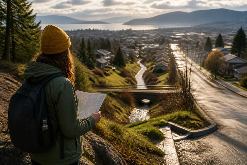
A watershed walk can show you where rain travels long before it reaches a stream. Follow the slopes, channels and drains around a familiar place, and the landscape begins to read like a route map drawn in water.
What does a watershed walk reveal?
A watershed is the area of land that drains toward a shared outlet, such as a stream, lake or bay. Its boundary usually follows higher ground: rain falling on one side flows toward one outlet, while water on the other side heads elsewhere.
A walk makes that boundary tangible. Look for ridgelines, hills, road crowns and other rises that divide nearby flows. Then notice the lower ground where runoff gathers: shallow hollows, ditches, culverts and streambeds. You do not need to see flowing water to infer its likely route.
That route is not always a neat line. Soil can absorb rain, pavement can send it quickly downhill, and drains can redirect it beneath a street. A watershed walk is an exercise in reading connections, not tracing a single visible channel.
Where should you start?
Start somewhere safe with a clear view of the surrounding land: a public park, a marked trail, a neighborhood sidewalk or a hilltop overlook. Choose a route that lets you observe higher and lower ground without crossing private property or entering restricted areas.
Before setting out, find a local watershed or drainage map from a municipal, regional or conservation agency. A paper map or a map app with contour lines can help identify streams and ridges. Treat mapped drains as clues rather than a complete record: small channels and buried pipes may not appear.
Pick one recognizable starting point, such as a trail entrance or street corner. From there, ask a simple question: if rain landed here, which direction would the ground carry it? Keep your answer tentative until the terrain offers more evidence.
How can you follow rain downhill?
Look across the ground for a sequence, not a dramatic stream. A gentle slope may lead to a shallow depression; that depression may connect to a roadside ditch, then a culvert, and eventually a creek. Each feature is a possible link in the route.
Contours help. On a topographic map, closely spaced contour lines generally indicate a steeper slope, while contours bending around a channel can point toward higher ground. The watercourse usually lies in the lower direction where those bends form a valley. On the ground, compare the height of curbs, path edges and visible banks rather than relying on one clue.
Urban surfaces complicate the reading. A storm drain may carry water under a rise that would otherwise divide the flow. A curb can funnel runoff along a road, and a parking lot can send it toward an inlet. Notice these structures, but do not open, enter or interfere with them.
Say you begin at a public library on a gently sloping street. The curb falls toward a grated inlet, and a small creek is marked on a map beyond the next block. You can reasonably infer that street runoff may enter the drain and continue toward that creek, while noting that the underground connection is not visible from the sidewalk.
What should you look for along the route?
Look for places where the water’s path changes or becomes easier to see:
- Ridges and high points: These can separate neighboring drainage areas. Check which side of the rise your route occupies.
- Shallow hollows: A low strip between slopes may collect runoff even when it is dry.
- Roadside ditches: These can carry water parallel to a road before directing it toward a culvert or stream.
- Culverts and bridges: A channel passing under a path or road can reveal that the watercourse continues on the other side.
- Stream junctions: Where smaller channels meet, note which direction the combined flow would take.
- Surface changes: Pavement, compacted paths, planted ground and exposed soil handle rainfall differently.
Observe from public paths and stable ground. Do not step into water, climb steep banks or approach fast-moving runoff. Conditions after rain can change quickly, and a dry channel can still be an unsafe place to stand.
How do local choices affect the route?
Land use changes how rain moves before it reaches a stream. Roofs and paved lots shed water; gardens and wooded ground may slow or absorb more of it, depending on soil, slope and saturation. Drainage systems can connect places that appear separate at street level.
Those connections matter beyond one block. Water can carry soil, litter and other material downstream, while a wetland or vegetated strip may slow its movement. A watershed is therefore a useful way to see how decisions made in one part of a landscape can affect places farther along the same water route.
Keep the observation specific. Instead of deciding that a whole neighborhood is “well drained,” note that a paved slope leads to a storm inlet, or that a planted hollow appears to hold water. These descriptions distinguish what you can see from what you are inferring.
What questions come up on a watershed walk?
How do I know which way water flows?
Use the slope and the position of channels, curbs and drains to make a likely reading. A local drainage map can help confirm the larger direction, though buried pipes may hide the route between visible points.
Can I follow a watershed without rain?
Yes. Ridges, hollows, culverts and stream valleys remain visible in dry weather, and they can show where runoff is likely to travel. Dry conditions also make it easier to observe without approaching moving water.
Does a storm drain lead to the nearest stream?
Not necessarily. Drainage networks can route water through underground pipes, storage areas or treatment systems before it reaches a waterway. Unless a public map identifies the connection, record it as a possibility rather than a fact.
Is a watershed the same as a river basin?
The terms overlap: both describe land that drains toward a shared water body or outlet. “Watershed” often refers to a smaller drainage area in American usage, while “basin” may describe a larger one, but local agencies can use the terms differently.
How can you keep useful notes?
A simple record helps separate visible clues from assumptions. On a phone or paper map, mark your starting point, the direction of slope, and any visible ditch, inlet, culvert or stream junction. Add short observations such as “pavement slopes east toward grate” rather than a conclusion about where every drop goes.
If you take photographs, include a recognizable public landmark and avoid framing private yards or people. Compare the route with a public watershed map afterward. If the map and your observation seem to conflict, note the mismatch; a hidden drain or a small change in elevation may explain it.
For a first watershed walk, follow one likely path from a public high point toward a visible channel, then stop where the route becomes uncertain. That uncertainty is part of the map: it shows where the landscape’s visible clues end and its hidden connections begin.